County Map
[fusion_builder_container hundred_percent=”no” hundred_percent_height=”no” hundred_percent_height_scroll=”no” hundred_percent_height_center_content=”yes” equal_height_columns=”no” menu_anchor=”” hide_on_mobile=”small-visibility,medium-visibility,large-visibility” status=”published” publish_date=”” class=”” id=”” background_color=”” background_image=”” background_position=”center center” background_repeat=”no-repeat” fade=”no” background_parallax=”none” enable_mobile=”no” parallax_speed=”0.3″ video_mp4=”” video_webm=”” video_ogv=”” video_url=”” video_aspect_ratio=”16:9″ video_loop=”yes” video_mute=”yes” video_preview_image=”” border_size=”” border_color=”” border_style=”solid” margin_top=”” margin_bottom=”” padding_top=”” padding_right=”” padding_bottom=”” padding_left=””][fusion_builder_row][fusion_builder_column type=”1_1″ layout=”1_1″ spacing=”” center_content=”no” link=”” target=”_self” min_height=”” hide_on_mobile=”small-visibility,medium-visibility,large-visibility” class=”” id=”” background_color=”” background_image=”” background_image_id=”” background_position=”left top” background_repeat=”no-repeat” hover_type=”none” border_size=”0″ border_color=”” border_style=”solid” border_position=”all” border_radius=”” box_shadow=”no” dimension_box_shadow=”” box_shadow_blur=”0″ box_shadow_spread=”0″ box_shadow_color=”” box_shadow_style=”” padding_top=”” padding_right=”” padding_bottom=”” padding_left=”” margin_top=”” margin_bottom=”” animation_type=”” animation_direction=”left” animation_speed=”0.3″ animation_offset=”” last=”no”][fusion_title hide_on_mobile=”small-visibility,medium-visibility,large-visibility” class=”” id=”” content_align=”left” size=”1″ font_size=”” line_height=”” letter_spacing=”” margin_top=”” margin_bottom=”30px” margin_top_mobile=”” margin_bottom_mobile=”” text_color=”#348e49″ style_type=”underline solid” sep_color=”#f44336″]
COUNTY MAP
[/fusion_title][fusion_text columns=”” column_min_width=”” column_spacing=”” rule_style=”default” rule_size=”” rule_color=”” hide_on_mobile=”small-visibility,medium-visibility,large-visibility” class=”” id=””]
Position and Size
The County lies between latitude 00 28’ and latitude 10 30’ North of the Equator, and longitude 340 20’ East and 350 15’ East of the Greenwich Meridian. The County covers an area of 3032.4 Km2. It boarders the republic of Uganda to the North west, Trans-Nzoia County to the North-East, Kakamega County to the East and South East, and Busia County to the West and South West. Map 1 shows the location of Bungoma County in Kenya.
Physical and Topographic features
The major physical features include Mt. Elgon, several hills (Chetambe, Sang’alo and Kabuchai), rivers (Nzoia, Kuywa, Sosio, Kibisi and Sio-Malaba/Malakisi), waterfalls such as Nabuyole and Teremi. Mt. Elgon and Sang’alo hill have attractive caves. The altitude of the County ranges from over 4,321m (Mt. Elgon) to 1200m above sea level. The County has only one gazetted forest, the Mt. Elgon forest reserve which measures 618.2Km2, and one National park, which measures 50.683 Km2.
[/fusion_text][/fusion_builder_column][/fusion_builder_row][/fusion_builder_container][fusion_builder_container hundred_percent=”no” hundred_percent_height=”no” hundred_percent_height_scroll=”no” hundred_percent_height_center_content=”yes” equal_height_columns=”no” menu_anchor=”” hide_on_mobile=”small-visibility,medium-visibility,large-visibility” status=”published” publish_date=”” class=”” id=”” background_color=”” background_image=”” background_position=”center center” background_repeat=”no-repeat” fade=”no” background_parallax=”none” enable_mobile=”no” parallax_speed=”0.3″ video_mp4=”” video_webm=”” video_ogv=”” video_url=”” video_aspect_ratio=”16:9″ video_loop=”yes” video_mute=”yes” video_preview_image=”” border_size=”” border_color=”” border_style=”solid” margin_top=”” margin_bottom=”” padding_top=”” padding_right=”” padding_bottom=”” padding_left=””][fusion_builder_row][fusion_builder_column type=”1_3″ layout=”1_2″ spacing=”” center_content=”no” link=”” target=”_self” min_height=”” hide_on_mobile=”small-visibility,medium-visibility,large-visibility” class=”” id=”” background_color=”” background_image=”” background_image_id=”” background_position=”left top” background_repeat=”no-repeat” hover_type=”none” border_size=”0″ border_color=”” border_style=”solid” border_position=”all” border_radius=”” box_shadow=”no” dimension_box_shadow=”” box_shadow_blur=”0″ box_shadow_spread=”0″ box_shadow_color=”” box_shadow_style=”” padding_top=”” padding_right=”” padding_bottom=”” padding_left=”” margin_top=”” margin_bottom=”” animation_type=”” animation_direction=”left” animation_speed=”0.3″ animation_offset=”” last=”no”][fusion_text columns=”” column_min_width=”” column_spacing=”” rule_style=”default” rule_size=”” rule_color=”” hide_on_mobile=”small-visibility,medium-visibility,large-visibility” class=”” id=””]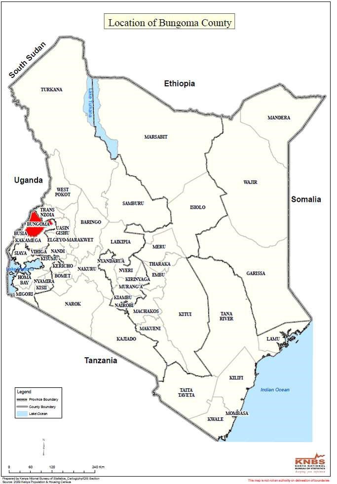 [/fusion_text][/fusion_builder_column][fusion_builder_column type=”2_3″ layout=”1_2″ spacing=”” center_content=”no” link=”” target=”_self” min_height=”” hide_on_mobile=”small-visibility,medium-visibility,large-visibility” class=”” id=”” background_color=”” background_image=”” background_image_id=”” background_position=”left top” background_repeat=”no-repeat” hover_type=”none” border_size=”0″ border_color=”” border_style=”solid” border_position=”all” border_radius=”” box_shadow=”no” dimension_box_shadow=”” box_shadow_blur=”0″ box_shadow_spread=”0″ box_shadow_color=”” box_shadow_style=”” padding_top=”” padding_right=”” padding_bottom=”” padding_left=”” margin_top=”” margin_bottom=”” animation_type=”” animation_direction=”left” animation_speed=”0.3″ animation_offset=”” last=”no”][fusion_text columns=”” column_min_width=”” column_spacing=”” rule_style=”default” rule_size=”” rule_color=”” hide_on_mobile=”small-visibility,medium-visibility,large-visibility” class=”” id=””]
Ecological conditions
The County environment supports a complex pattern and balance of relationships between plants, animals, people and manmade features. These complex interactions lead to different selective pressures on organisms, leading to natural selection which causes population of species to evolve. Variation in nutrients and accumulation of toxins due to human activities have affected the ability of the environment to support life systems. Mt. Elgon forest ecosystem supports diverse life systems contributing immense goods (fruits, tubers, medicinal herbs, game meat, timber, logs, poles, firewood, fodder etc) and services (shed, pollination, decomposition, evaporation, absorption of CO2, nutrient formation, recreation, spiritual and cultural values etc).
The expanding County population accompanied by increasing agricultural activities have reduced spaces for fauna and flora. Excessive use of artificial fertilizers for instance has affected soil nutrients, insects and certain bacteria niches thereby affecting nitrogen conversion for plants, leading to variability in yields. These and other related processes have led to co-evolution where species evolve in response to each other as seen from bees and the flowers they pollinate to preditors and the prey they eat.
Climatic conditions
The County experiences two rainy seasons, the long rains of March to July and short rains
August to October. The annual rainfall in the County ranges from 400mm (lowest) to 1,800mm (highest). The annual temperature in the County vary between 0°C and 32°C due to different levels of altitude, with the highest peak of Mt. Elgon recording slightly less than 0°C. The average wind speed is 6.1 km/hr. In the last decade, the County experienced increasing variability in rainfall and temperature patterns that have influenced changes in agricultural seasons.
[/fusion_text][/fusion_builder_column][/fusion_builder_row][/fusion_builder_container]